
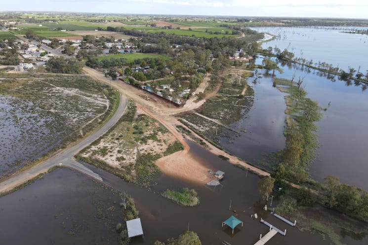
LOCALS have been advised to expect "potential road and ferry closures, disruptions to the power network and reduced services" as predicted River Murray flow levels continue to rise.
The state government today announced predicted River Murray flow levels into South Australia would increase to at least 175GL/day by December "due to ongoing rain throughout the Murray-Darling Basin".
Premier Peter Malinauskas said a moderate chance of 200GL/day, and a lower probability of 220GL/day still remained.
"Significant rain interstate over the past week increases the likelihood of flooding, particularly for low-lying Riverland and Murrayland communities," Mr Malinauskas said.
"State government agencies are working around the clock with councils, landholders and communities to prepare for the huge volume of water coming across the border."
SES chief officer Chris Beattie said "increased flow figures suggest that the River Murray flood event will continue over a prolonged period, well into January and likely into February 2023".
"We have significant contingency plans in place and emergency responses will continue to be provided to the community as the flood levels increase," Mr Beattie said.
"Updated flow data will be made available more frequently to the River Murray communities to assist in flood preparedness."
Minister for Emergency Services Joe Szakacks advised Riverlanders to "prepare for the worst case scenario so we get through this event without any risk to life and with minimal impact on property".
The state government advised Bookpurnong Road was expected to be closed between Berri and Kemp Road "potentially as soon as this weekend", with a detour available via Stanitzki Road and Sturt Highway, through Paringa and Renmark.
Further information regarding the current Murray River flood event can be found by visiting the website (www.environment.sa.gov.au/topics/river-murray/river-murray-high-flows#high-flows-maps).


